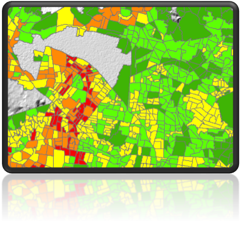
#1 – EO-based risk products
Exploit Earth Observation (EO) data to develop value-added mapping products depicting the risk to urban infrastructure (private/public buildings, transport networks) caused by overexploitation of groundwater resources and induced land subsidence, that can be embedded into risk management and mitigation workflows
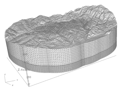
#2 – 3D numerical models
Develop innovative and physics-based numerical models, coupling 3D transient groundwater flow models with geomechanical models, capable to quantify the effects of groundwater usage to land subsidence/uplift and assess uncertainty

#3 – Socio-economic impacts & future scenarios
Further advance the knowledge on subsidence-induced socio-economic impacts (market and non-market direct/indirect losses), and identify how human and climate change drivers can influence subsidence-induced risk in the next decades (i.e. 2050 and 2100)