SubRISK+ triple presence at MedGU, AIT and LaSII/GSEU events

During the week 10-14 November 2025, SubRISK+ team actively took part in an intense series of research dissemination activities, in the framework of three scientific conferences/workshops:

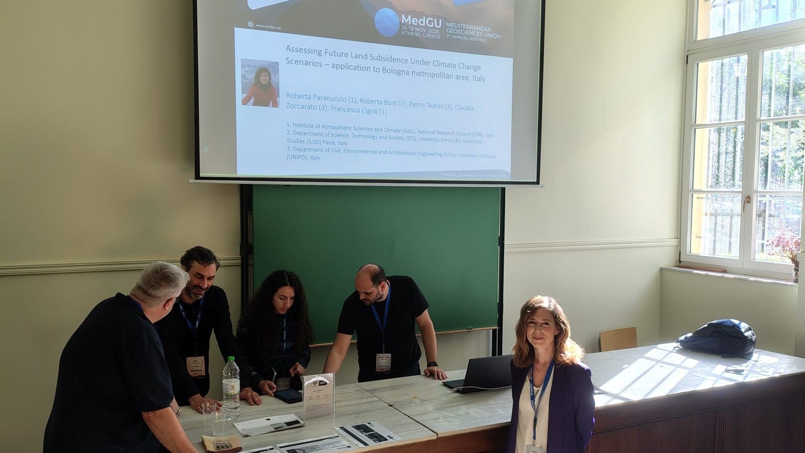
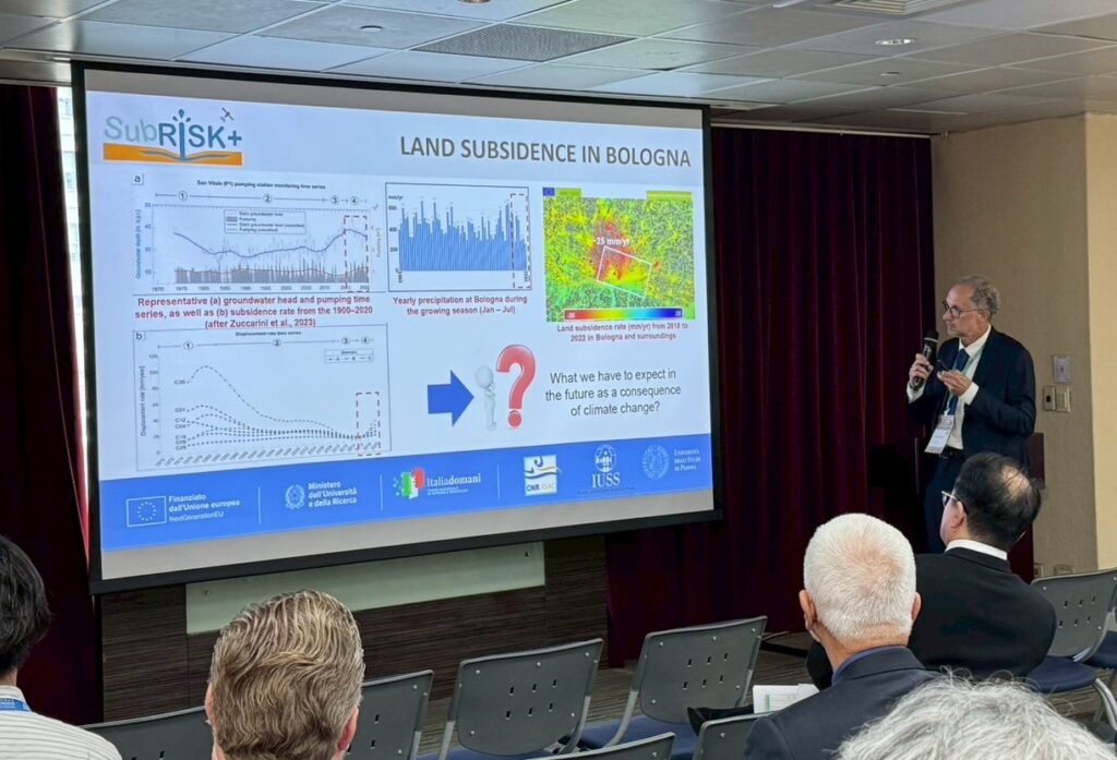
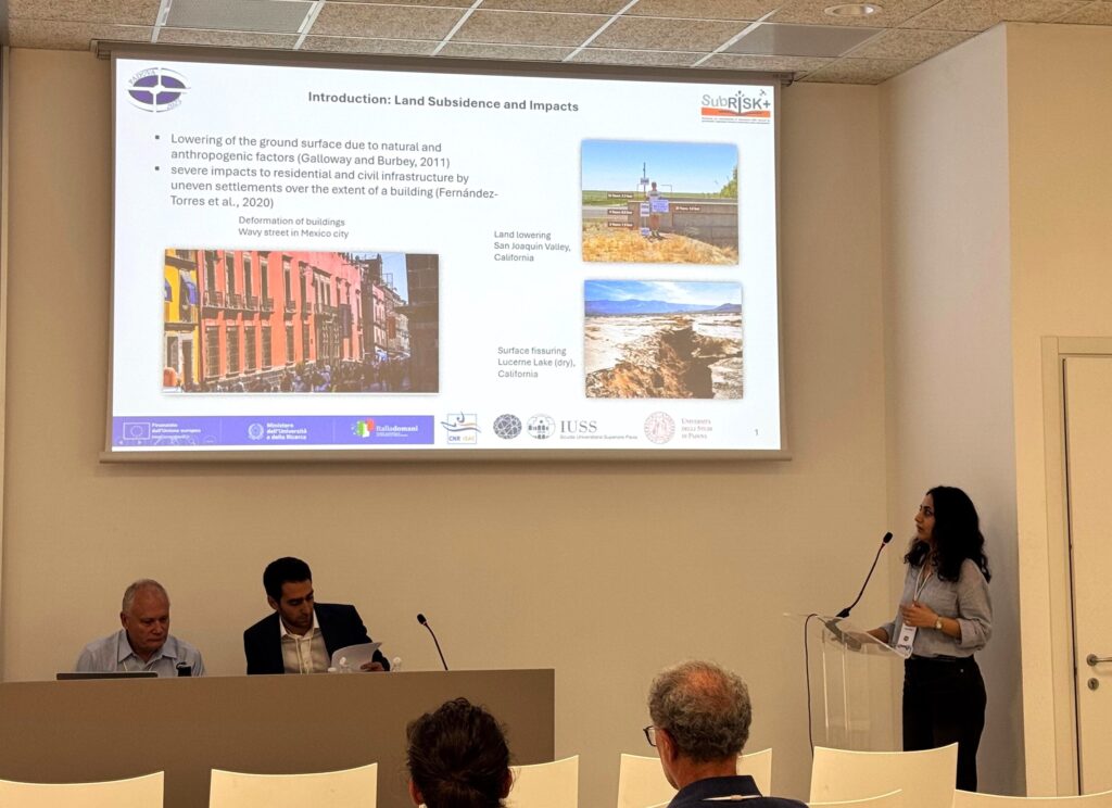
At MedGU 2025, Paranunzio et al. delivered an oral presentation on assessing future land subsidence under climate change scenarios, with application to Bologna metropolitan area, which contributed to the Track 17 (Special Session): Land Subsidence: Triggers and Monitoring. This work is the first scientific output of SubRISK+ WP6 on Future Scenarios Analysis, aiming to assess future subsidence risk by 2050 and 2100 under different climate change scenarios accounting for urban population evolution in the 15 metropolitan cities of Italy.

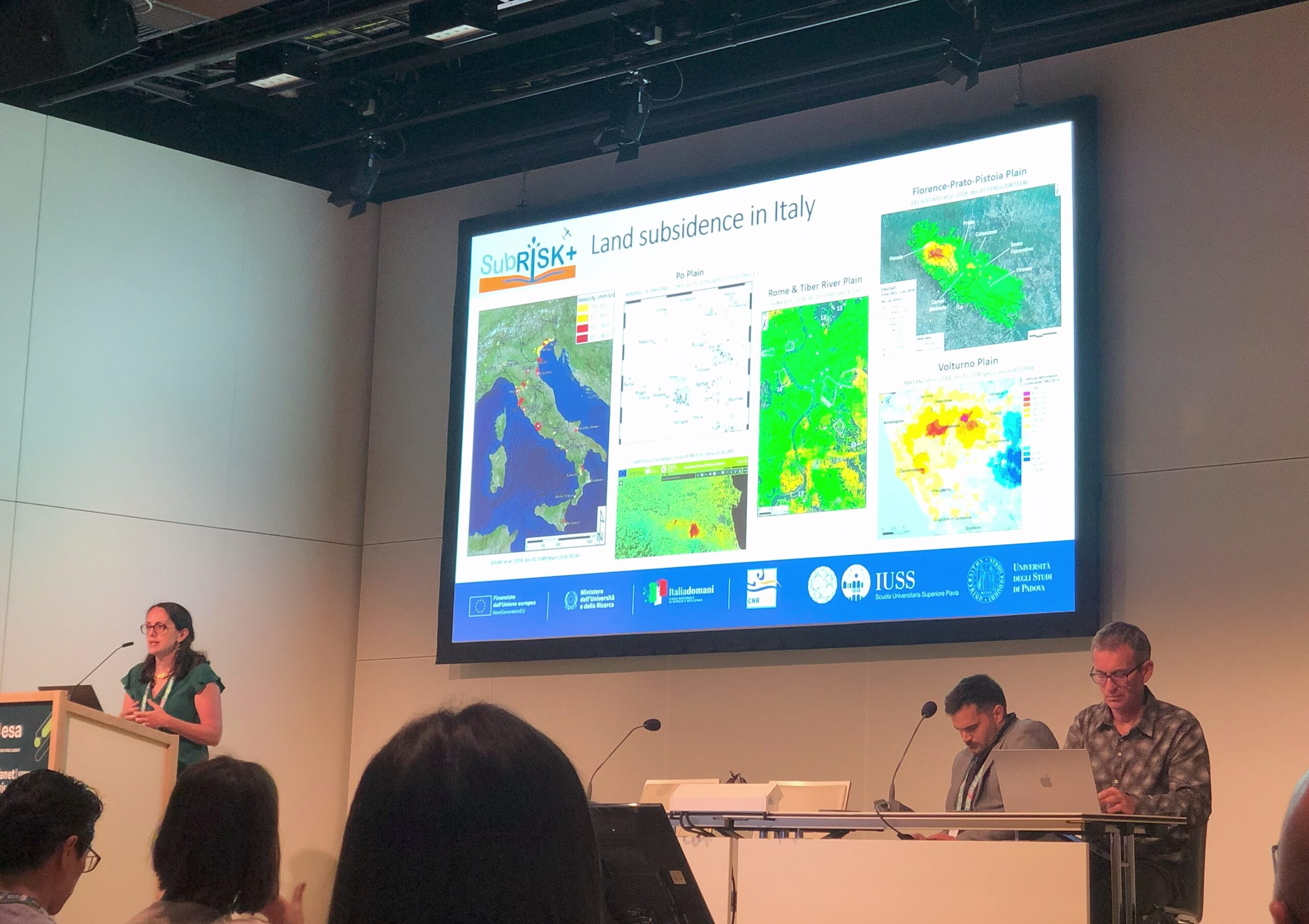
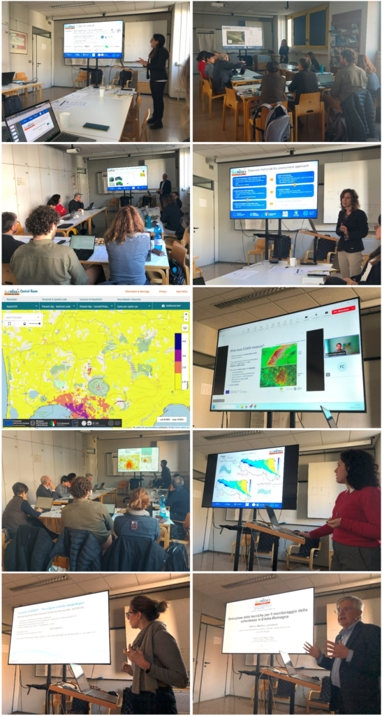
Soon after MedGU, an oral contribution by Cigna et al. was presented at the AIT conference, within the thematic session T3-2 “Natural Hazard”, with a focus on the satellite InSAR-based assessment of present-day land subsidence hazard and risk in the metropolitan cities of Italy. This work was conducted in 2024 by SubRISK+ team as part of WP2 on National scale risk assessment; its core outputs are openly available in digital form within the ‘Control Room’, and described detail in the accompanying report (see DEL2.1 and DEL2.2 in the Deliverables page). The full conference programme of AIT can be accessed here.

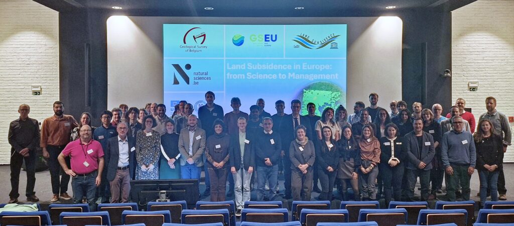
Finally, a set of three key scientific contributions were delivered at the LaSII/GSEU workshop (see more details and full programme within LaSII webpage here), with:

  • Cigna et al. opening the session on Scientific advantages of drivers, monitoring and modelling of land subsidence with a talk on monitoring land subsidence and its induced risk to urban infrastructure using satellite InSAR in Italy;
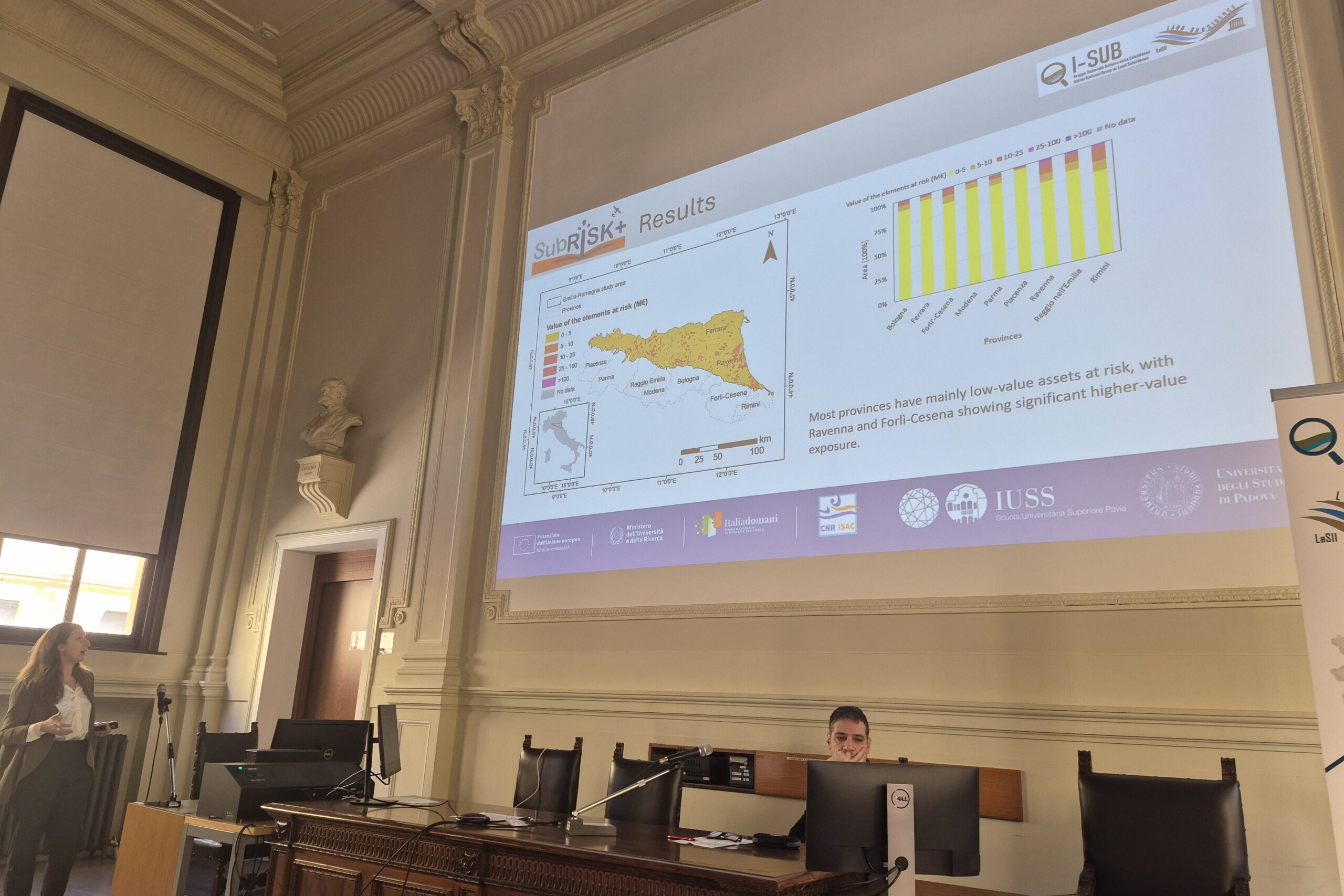
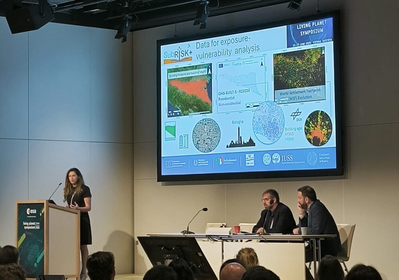
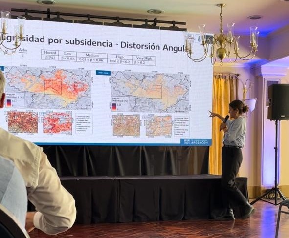
  • Bonì et al. presenting a poster on InSAR-based assessment of risk levels from differential land subsidence to support sustainable urban land use planning, with application in Emilia-Romagna region, Italy; and
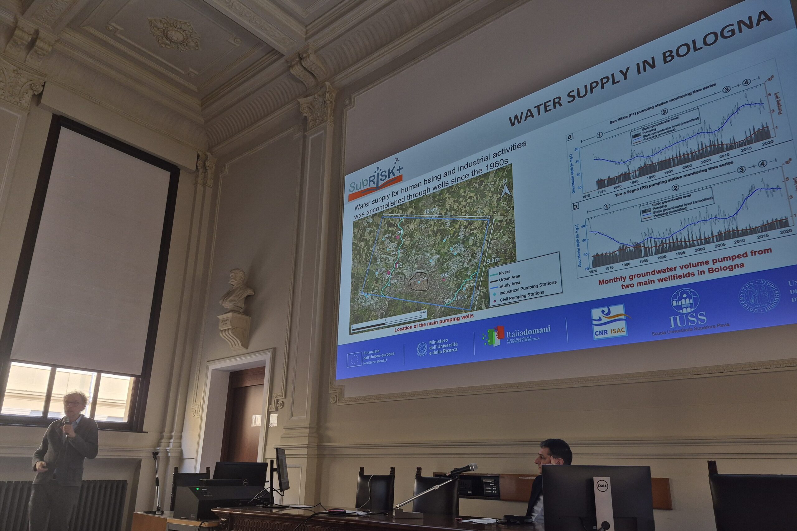
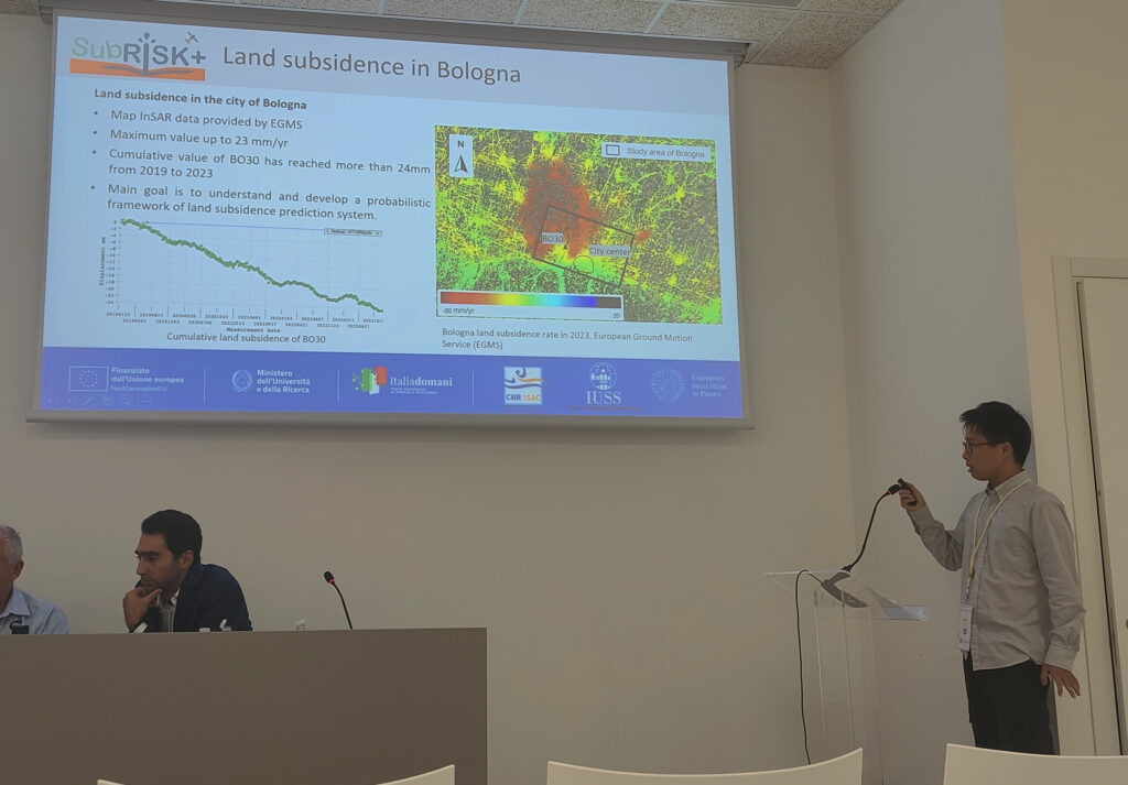
  • Tang et al. presenting another poster on coupled 3D flow-geomechanical differential land subsidence modeling with InSAR-based data assimilation in Bologna.

These presentations involved key results from SubRISK+ WP2 and WP3 on national and regional scale risk assessment, and WP4 on advanced modeling at the local scale.

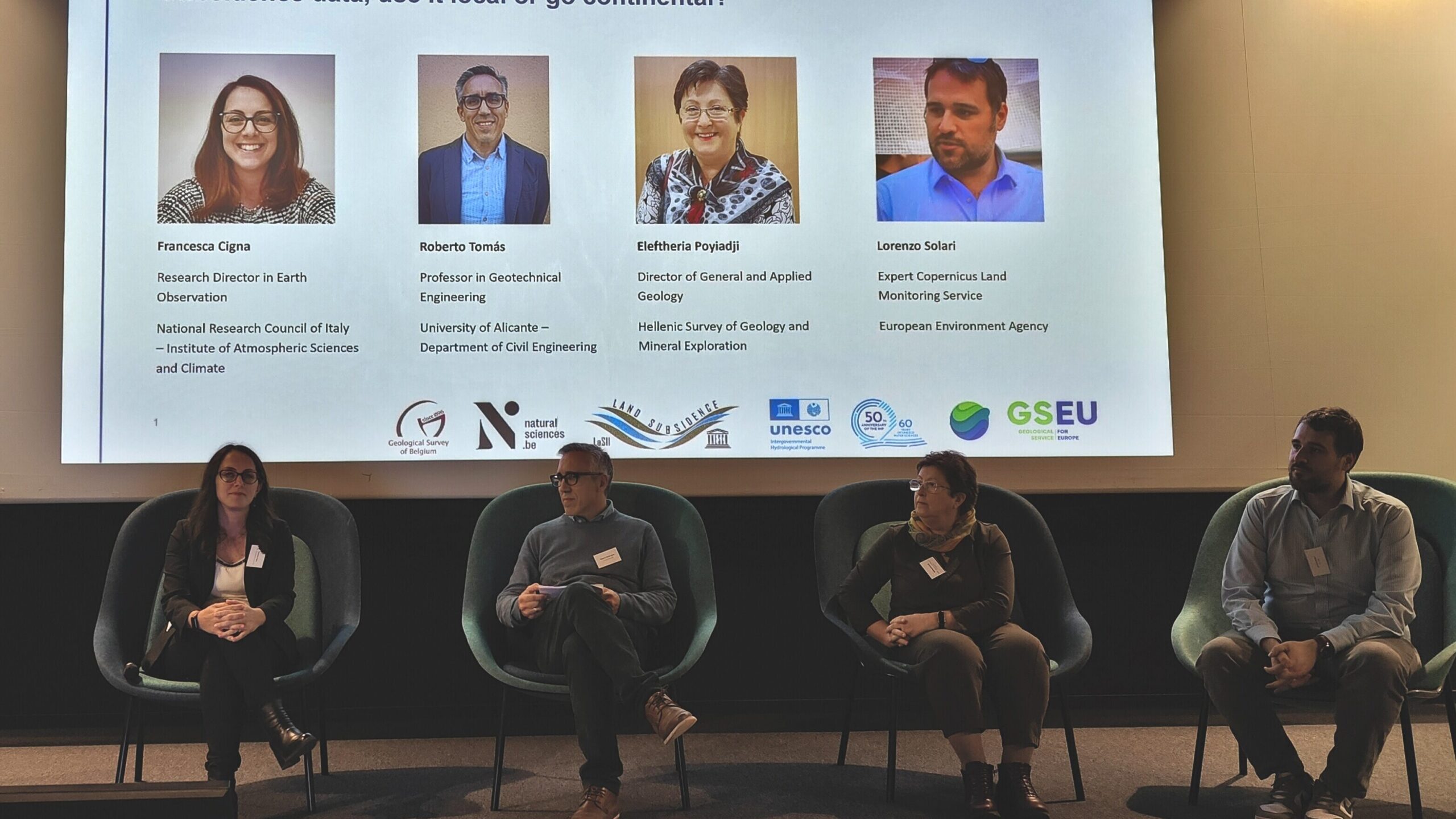
Moreover, in his role of current chair of the UNESCO LaSII working group, Prof P. Teatini opened the LaSII/GSEU workshop along with Dr J. Hollis (Secretary General of EuroGeoSurveys, EGS) and Dr L. Folin-Calabi (Director of the UNESCO Liaison Office in Brussels and Representative to the EU); while Dr F. Cigna participated in the Panel Discussion on “Subsidence data, use it local or go continental?“, together with lead experts from the University of Alicante, the Hellenic Survey of Geology and Mineral Exploration, and the European Environment Agency (EEA).

Overall, this wealthy and productive week of events provided a range opportunities not only to present SubRISK+ project to the scientific community, but most importantly to get together with many national and international land subsidence experts from academia, industry and policy institutions, and discuss this widespread geological process, available monitoring and modeling techniques and their performances, the impacts caused to urban environments, and future research directions in this field.

SubRISK+ team lands in Taipei and Padua for the TGA and SIMP-SGI 2025 conferences

Newly developed 3D numerical models and land subsidence risk maps were presented by the SubRISK+ team at two scientific conferences in June-September 2025:

At TGA2025, Teatini et al. delivered a talk on the stochastic approach developed in SubRISK+ to investigate differential land displacements due to groundwater overdraft in the city of Bologna (Italy), as part of the thematic session: 3rd LAnd Subsidence induced by fluid ExtRaction (LSUB). This work is the baseline for the advanced 3D modeling led by UNIPD within WP4.
See the full scientific program and more information within the conference website.

At SIMP-SGI, two oral talks were presented by the team. In particular, Tang et al. showcased how 3D geostatistics and 3D numerical models are coupled within WP4 to characterize uneven land subsidence in Bologna, Italy; whereas, Goli Raeisi et al. illustrated the experiments carried out within WP3 to test the capability of satellite-based InSAR data to assess differential subsidence risk in the Emilia-Romagna region, Italy.
Both talks contributed to the specialist discussion on Monitoring the Earth for Hazards: Integrating Geology, Geophysics, and Risk Assessment, within session S30.
The full scientific programme of the workshop plus some side events (such as the PhD day), and many other details are available within the conference website.

Two talks presented by the SubRISK+ team at ESA LPS 2025 in Vienna

Two oral talks were delivered by the SubRISK+ team during the Living Planet Symposium 2025 (LPS2025) on 23-27 June 2025, organised in Vienna by the European Space Agency (ESA).

One presentation aimed to present the results of the national scale risk assessment, with a focus on enhancing the understanding of present-day and future urban subsidence risk in Italy based on multi-scale satellite InSAR workflows and advanced modelling (Cigna et al. 2025), while the other focused on the regional scale analysis, with a focus on InSAR-based regional land subsidence risk assessment in the Emilia Romagna region (Bonì et al. 2025). Both presentations contributed to the thematic session B.04.01 Satellite based terrain motion mapping for better understanding geohazards (see full programme: Part 1 & Part 2), held on 24 June, in the framework of Theme B. Climate Action and Sustainability ChallengesSub-theme 04 Managing Extremes and Environmental Risks.

LPS2025 scientific programme, full abstracts and presentations are available in the dedicated page within the conference website.

SubRISK+ poster at EGU2025 in Vienna

SubRISK+ team successfully delivered a poster presentation at the international conference EGU General Assembly 2025 in Vienna (Austria), on 27 April – 2 May 2025.

The work focused on the integration of EO data into land subsidence risk mapping at the regional scale in Emilia-Romagna, which is the core of WP3, and contributed to the scientific discussions of the thematic session ITS1.21/NH13.9 on Integrating Imaging Geodesy and Artificial Intelligence for Natural Hazard Resilience and Disaster Management.

A PDF copy of the abstract can be accessed here: 🗎

SubRISK+ meets stakeholders and end-users in Bologna

A tailored end-user workshop for SubRISK+ stakeholders from Emilia-Romagna Region (RER), the Regional Agency for Prevention, Environment and Energy of Emilia-Romagna (ARPAE) and the Po River District Basin Authority (AdBPo) took place on 21 February 2025. The workshop was hosted by CNR-ISAC in its headquarters, within CNR Bologna Territorial Research Area.

The workshop agenda was structured around three main interconnected blocks:

(1) a specific focus on SubRISK+ goals and objectives, work packages and mid-term results, provided by SubRISK+ research teams from CNR-ISAC, IUSS and UNIPD;

(2) an invited presentation on Copernicus Land Monitoring Service (CLMS) products and, specifically, the European Ground Motion Service (EGMS), delivered by the European Environment Agency (EEA);

(3) the detailed perspective on the Emilia-Romagna region case study, provided by SubRISK+ stakeholders from RER, ARPAE and AdBPo, along with distinguished speakers from the Department of Civil, Chemical, Environmental, and Materials Engineering (DICAM) at the University of Bologna.

During the first block, CNR-ISAC together with INKODE Soc. Coop. also delivered a demo of the first release of SubRISK+ Control Room. This web platform enables open access to the project hazard and risk mapping products, and currently hosts the results of the national scale risk assessment delivered by WP2.

All along its duration, the workshop enabled a productive and lively discussion among the whole project consortium, with a focus on the key themes of SubRISK+, including mapping land subsidence hazard and risk using satellite data, advanced modelling of the aquifer system of Bologna, assessing socio-economic impacts and future scenarios of risk at the national, regional and local scales.

The consortium identified shared pathways to enhance SubRISK+ mapping products and to further increase their potential exploitation to support land subsidence risk management, thus paving the way for a productive continuation of the project activities during the next months, and further collaboration opportunities in the future.

SubRISK+ poster presentation at AGU 2024 in Washington, D.C.

A poster presentation on advanced stochastical modelling of the process of land subsidence in Bologna (Italy) was delivered by SubRISK+ team during the American Geophysical Union (AGU) Annual Meeting AGU24 in Washington D.C. on 9-13 December 2024.

The poster contributed to the thematic session EP43A – Land Subsidence and Relative Sea Level Rise: Assessments, Projections, and Mitigation in Natural and Urban Environments, successfully led as part of the Earth and Planetary Surface Processes section’s program.

The full abstract is available from the conference webpage here, and a PDF copy of the poster can be downloaded from the Publications webpage.

SubRISK+ participation to ENGULF regional workshop in Accra

The project team participated to the First West African Regional Workshop on Coastal Land Subsidence regional workshop on 4-8 November 2024, organised in the framework of the ENGULF Research Programme in Accra, Ghana, organized under the auspices of the UNESCO Land Subsidence International Initiative (LaSII).

An oral talk was delivered on land subsidence risk caused by groundwater exploitation in Italy, during the thematic session on Mechanisms & Understanding.

The workshop agenda and flyer can be accessed from the Agence Française de Développement (AFD)’s website here.

Two SubRISK+ talks presented at IEEE ARGENCON 2024 in Buenos Aires

Two oral talks were delivered during the IEEE Biennial Congress of Argentina (ARGENCON) on 18-20 September 2024, organised in Buenos Aires by the Argentinian section of IEEE.

One presentation focused on assessing long-term land subsidence hazard using PSInSAR data (Lenardón Sánchez et al. 2024), while the other one on characterizing land subsidence using Sentinel-1 InSAR and geostatistics (Farías et al. 2024). These works were carried out during two research internships at CNR-ISAC in Rome, Italy, in the framework of the University of Pavia’s Modulo ASI scholarships programme 2024.

ARGENCON scientific programme and the book of abstracts can be downloaded from the conference website, while the two conference proceedings were published on IEEE Xplore digital library and are available here: Lenardón Sánchez et al. 2024 & Farías et al. 2024.

Oral presentation during ESA URBIS24 in Frascati

On 16-18 September 2024, SubRISK+ team attended the URBan Insights from Space (URBIS24) workshop, organised by the European Space Agency (ESA) at ESA/ESRIN in Frascati (Italy).

An oral presentation was delivered during Session 5: Assessing and Mitigating Urban Hazards: Subsidence, Water Risks, and Flooding, with a focus on present-day and future urban subsidence risk in Italy based on multi-scale satellite InSAR workflows and advanced modelling.

The conference agenda provides session overviews and detailed presentation schedules, including full abstracts.